
The newest addition to a lengthy series of ocean-monitoring satellites, Sentinel-6 Michael Freilich, becomes the reference satellite for sea level measurements.
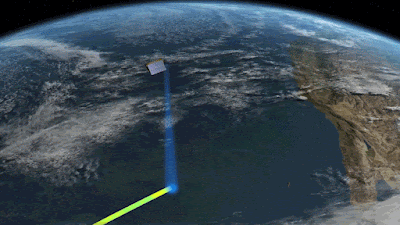
Sentinel-6 Michael Freilich, the newest US-European sea level satellite, became the official reference spacecraft for worldwide sea level observations on March 22.

- This implies that data acquired by other satellites will be compared to Sentinel-6 Michael Freilich's information to confirm that they are accurate.
- The satellite, which will be launched from Vandenberg Air Force Base in November 2020, will carry on the nearly 30-year legacy of the TOPEX/Poseidon satellite, which began measuring sea surface height in the early 1990s.
- Since then, a succession of successor satellites have continued the mission, the most recent of which is Sentinel-6 Michael Freilich.

Sentinel-6B, its twin, is set to debut in 2025.
"These missions, including Sentinel-6 Michael Freilich, are the gold standard when it comes to sea level measurements, which are critical for understanding and monitoring climate change," said Josh Willis, project scientist for Sentinel-6 Michael Freilich at NASA's Jet Propulsion Laboratory in Southern California.

Long-term sea level height measurements are essential for tracking how much and how quickly the waters are rising in a warming environment.
"We can't lose sight of how much the sea level has risen because if we do, it'll be difficult to anticipate what will happen in the next decades," Willis warned.
"The unprecedented precision of the sea level measurements provided by this mission ensures not only the continuity of a 30-year data record, but also allows us to better understand climate change and the impact of rising seas on coastal areas and communities," Julia Figa Saldana, ocean altimetry program manager at the European Organization for the Exploitation of Meteorological Satellites, said (EUMETSAT).

Sentinel-6 Michael Freilich settled into orbit 30 seconds after its predecessor, Jason-3, had launched.

Since launch, science and engineering teams have spent time ensuring sure Sentinel-6 Michael Freilich was collecting the data it was supposed to be gathering and that the data was correct.
- Last year, some of the early data was made accessible for activities such as weather forecasting.
- The experts decided that Sentinel-6 Michael Freilich should become the reference satellite for sea level observations following additional validation.

Jason-3 will be moved into an interleaved orbit later this year by teams.
- The ground track – or the strip of Earth that Jason-3's sensors observe as the satellite goes around the world – will run in between the ground tracks of Sentinel-6 Michael Freilich's consecutive orbits from that new point.
- Although Jason-3 will no longer function as the official reference sea level satellite, it will continue to measure sea level height from its interleaved orbit.
- However, by continuing to gather sea level data, Jason-3 will effectively quadruple the number of measurements observed by Sentinel-6 Michael Freilich on each pass, assisting in substantially improving the spatial resolution of both spacecraft' sea level measurements.
Sentinel-6 Michael Freilich is one of two satellites that make up the Copernicus Sentinel-6/Jason-CS (Continuity of Service) project.

It is named after former NASA Earth Science Division Director Michael Freilich.
- Sentinel-6/Jason-CS was developed in collaboration with ESA, EUMETSAT, NASA, and NOAA, with financing from the European Commission and performance assistance from CNES (France's National Centre for Space Studies).
- EUMETSAT is in charge of spacecraft monitoring and control, as well as the processing of all altimeter scientific data, on behalf of the EU's Copernicus program, with the help of all partner organizations.
- The Advanced Microwave Radiometer, the Global Navigation Spacecraft System Radio Occultation, and the Laser Retroreflector Array were all donated by JPL, a subsidiary of Caltech in Pasadena, for each Sentinel-6 satellite.
- NASA also provided launch services, ground systems to support the NASA scientific instruments' operations, science data processors for two of the sensors, and assistance for the United States' members of the international Ocean Surface Topography Science Team.
Find Jai on Twitter | LinkedIn | Instagram
You may also want to read more about Space Exploration and Space Systems here.


